![]()
![]()
![]()
![]()
![]()
|
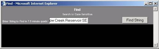
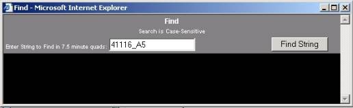
Lesson Three is a practical exercise that follows a typical record search query. We have a new project that lies on the Willow Creek Reservoir SE quad (41116-A5) in southern Elko County and want to identify all sites and inventories within 1 kilometer of the project area.
Or
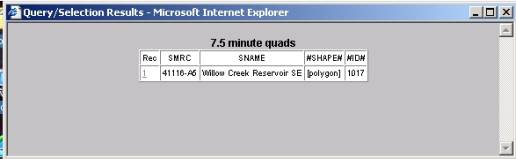
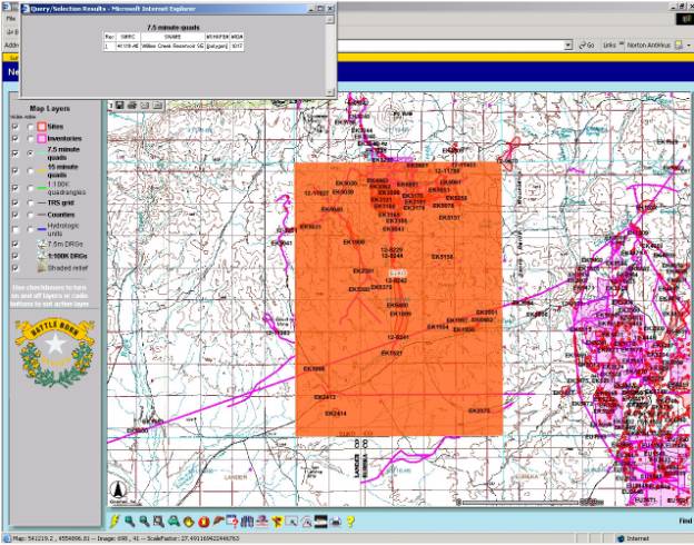
The Willow Creek Reservoir SE quad is highlighted in orange.
§
Left Click the Select Line/Polygon Button ![]() and draw the following project.
and draw the following project.
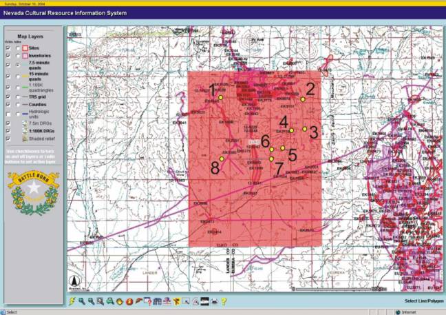
§ Double left click at point 8 to close the polygon.
§ Make the TRS grid Map Layer Active
§ Click the Select Line/Polygon Button
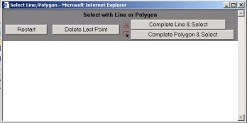
§ Left click the Complete Polygon & Select Button
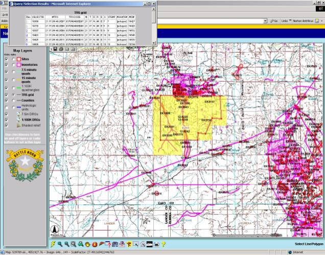
All Sections crossed by the project boundary are selected.
§ Left
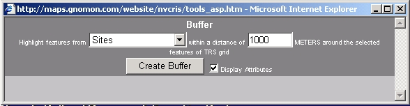
click the Buffer Button ![]() .
.
§ Highlight Sites within 1000 meters (1 km) of the selected TRS Grid. (Make sure to check the Display Attributes Box).
§ Left Click Create Buffer.
All Sites within 1 km of Sections within the Project Area are displayed.
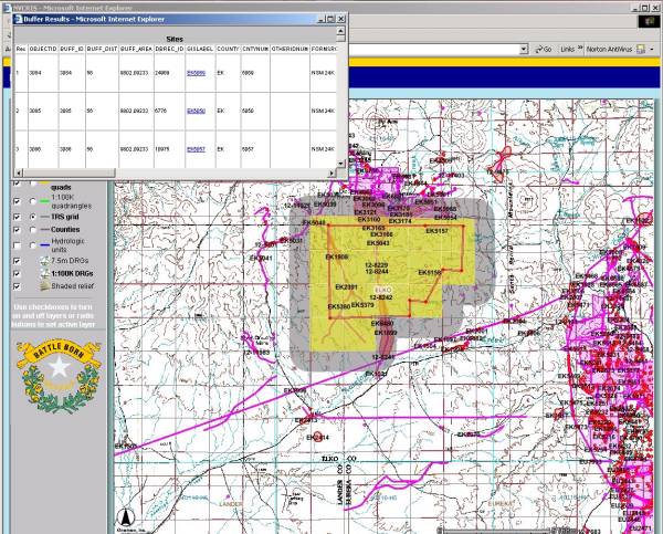
Click on the Blue Underlined site number to view a scanned site record.
To copy the Results to a spreadsheet
§ Right click in the Sites Box,
§ Left Click Select All,
§ Copy the selected records (Cntl C)
§ Paste (Cntl V) the selected dataset into a Spread Sheet.
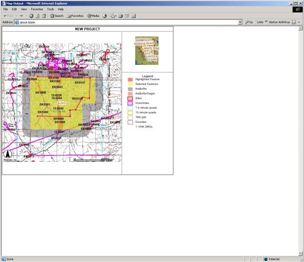
§ Drag the Zoom Button to zoom to the project area.
§ Select the Print Button.
§ Title your Map NEW PROJECT.
§ Left click Create Print Page.
§
A Search Results Map is displayed.
§
Select the Buffer Button ![]() .
.
§ Repeat the above process to identify all Inventories within the project area.
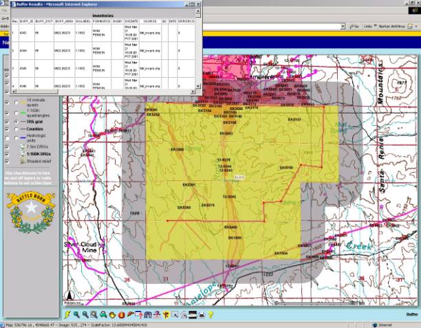
Create a Map or copy records if you wish.
This concludes your training session.
§
Clear all selections ![]() and return to the maps full extent
and return to the maps full extent ![]() .
.
Exit the WEB Browser.
|