![]()
![]()
![]()
![]()
![]()
|
In this lesson, you will explore the simple tools on the NVCRIS toolbar, and familiarize yourself with the ArcIMS environment.
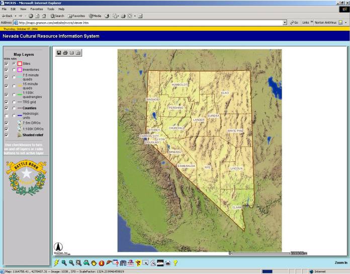
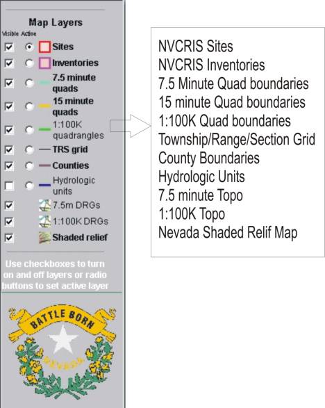
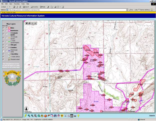
Use checkboxes and radio buttons to make Map Layers Visible or Active.
The shaded relief background image is no longer visible
For ease of display, some of the Map Layers are visible only when zoomed to a specific scale.
The zoom and pan buttons allow the user to move through different layers and to different parts of the map, exposing different layers of data.
The 1:100K map index layer is displayed.
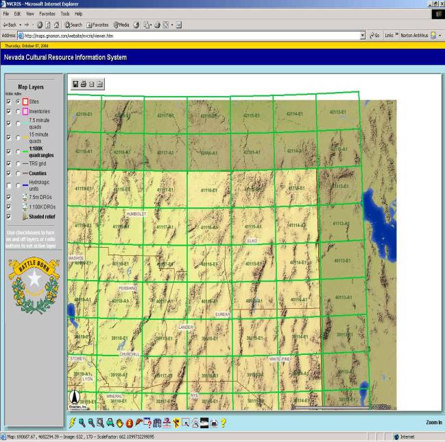
Release the left mouse button. The view is zoomed to a closer view. The 7.5 minute map index is displayed.
Select
the Pan Button ![]() and place
the cursor on the 41115-C7 quad.
and place
the cursor on the 41115-C7 quad.

Sites and inventories are shown and labeled on a 1:100,000 quad background
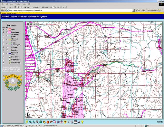
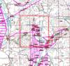
Sites and inventories are shown and labeled on a 7.5 minute quad background
The Hyperlink button ![]() links sites shown on the display to a scanned
site record.
links sites shown on the display to a scanned
site record.
§
Select the Hyperlink button ![]()
§
Make sure the Sites Layer is active.![]()
§ Place the icon over a red site on the display and left click
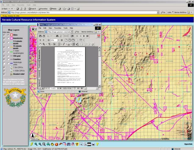
A scanned site record is displayed.
To return to the opening view:
As different layers are revealed on the map, simple queries can be address using the Identify and Find buttons.
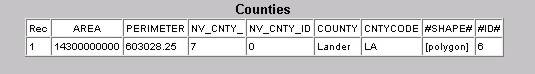
Note that the entry in the county field would serve as a unique identifier.
To search for a specific field or feature within the selected Layer;
§
Select the Find Button ![]()
![]() from
the Button bar.
from
the Button bar.
A box requesting an entry string appears below the map.
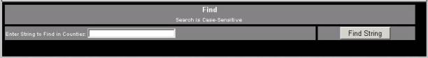
By entering an appropriate strings in the Counties attribute fields and that county will be highlighted on the map.
Note: The Search is Case Sensitive
Elko County is highlighted on the map, and a box with summarized attributes is placed below.
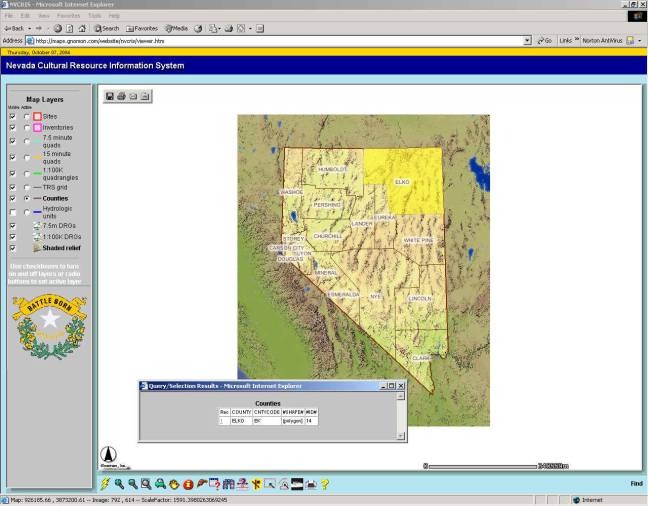
The map zooms to Elko County.
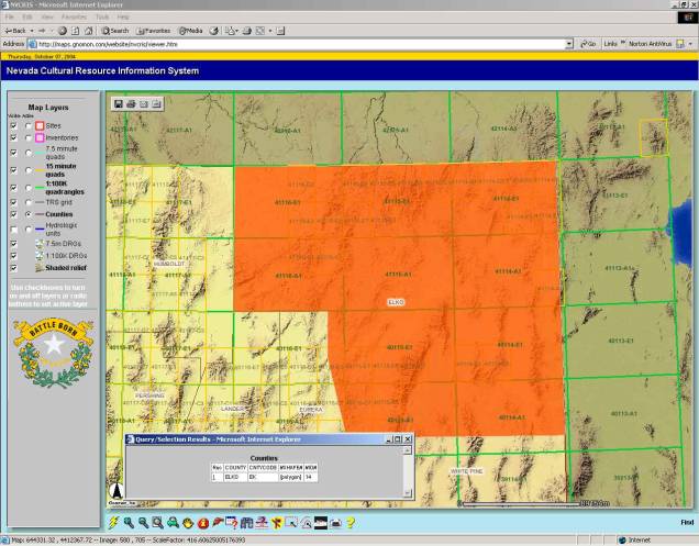
From here, the user can zoom into the appropriate map level using Zoom and Pan techniques.
To return to the opening view:
The Drill Down tool will identify any sites or inventories under a selected map point.
§
Using the Zoom In tool ![]() , left
click and drag a small rectangle over the word Washoe on the map display.
, left
click and drag a small rectangle over the word Washoe on the map display. 
A results screen displays all sites and inventories found under the selected drill down point.
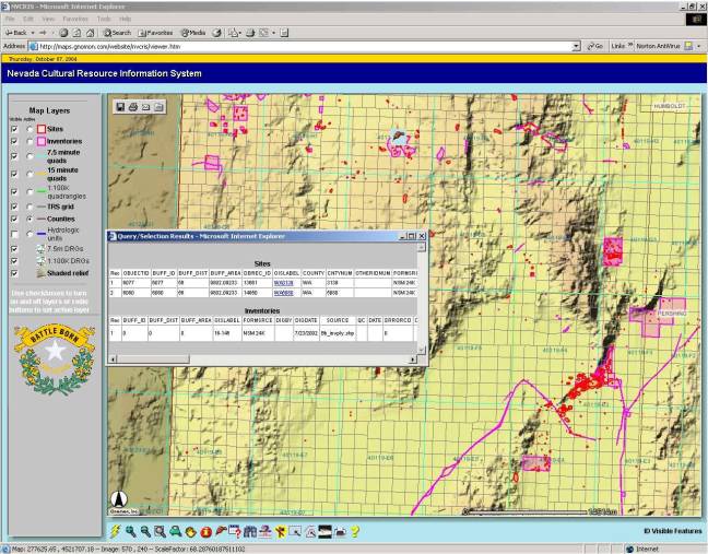
A scanned version of the site record appears.
§
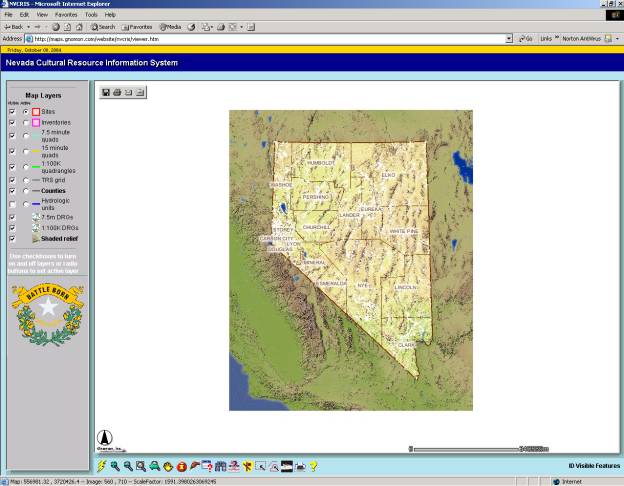
Select the Zoom to Last Extent ![]() button.
button.
The display returns to the last drawn image.
|